Is Belize Safe? The Advisory Levels, and the Crime Data Behind Them
On this page 12 sections
- Where the higher level…
- The three advisories side by…
- The two things US government…
- Murders by district — the…
- The caveat that matters more…
- The other major crimes, by…
- How Belize compares…
- What actually gets warned…
- The Guatemala-border forest…
- States of emergency: a…
- The risks that are not crime
- What the governments and…
Checked on 24 September 2026, against the US State Department’s own machine-readable advisory feeds, the UK FCDO content API, the Government of Canada’s advisory page, Belize Police Department crime figures published by the Belize Crime Observatory, Statistical Institute of Belize population estimates, and World Bank homicide data.
Belize is at Level 2: Exercise Increased Caution, dated 11 March 2026. The State Department’s wording is: “Exercise increased caution in Belize due to crime. Some areas have increased risk. Please read the entire Travel Advisory.” One area is a full level higher: Southside Belize City is Level 3: Reconsider travel — “Reconsider travel to Southside Belize City due to crime.”
Belize is not one risk number. It is a Level 2 country containing a Level 3 neighbourhood, and the crime statistics that exist are published mainly by district — a unit that puts Belize City and Ambergris Caye in the same row.
Ambergris Caye and Caye Caulker both sit inside that same Belize District, which is why nothing in the tables below can be read as a figure for either island.
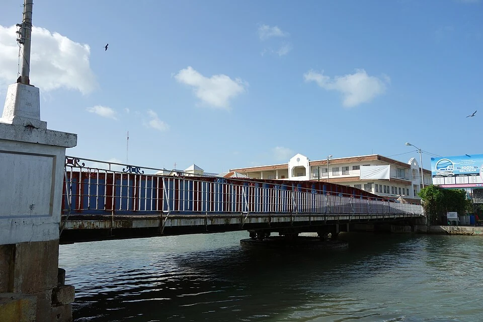
Where the higher level applies, exactly
The State Department draws the boundary as the south side of Belize City, from the Haulover Creek Canal continuing south to Fabers Road. Verbatim: “U.S. government employees are strongly discouraged from travel to the south side of Belize City from the Haulover Creek Canal continuing south to Fabers Road due to the danger of crime.”
Two other governments use the same northern edge. The UK FCDO writes “the area to the south of the Haulover Creek (known as Southside)”. Canada writes “Southside Belize City, south of the Haulover Creek River”. All three start the area at Haulover Creek; only the State Department names a southern limit, at Fabers Road. The UK and Canada leave the southern edge undefined.
The three advisories side by side
| Government | Country-wide level | Belize City exception | Dated |
|---|---|---|---|
| United States | Level 2: Exercise Increased Caution | Southside Belize City — Level 3: Reconsider travel | 11 March 2026 |
| Canada | Exercise a high degree of caution (with regional advisories) | Southside Belize City — Avoid non-essential travel | Last updated 24 September 2026, 08:53 ET (a health-section editorial change) |
| United Kingdom | No single level published; the safety and security page states “Belize has one of the highest per capita murder rates in the world.” | Serious gang-related violence “most frequently in Belize City, particularly in the area to the south of the Haulover Creek (known as Southside)” | Page last updated 12 June 2026 |
The 11 March 2026 US update carried its own change note: “There were no changes to the advisory level or risk indicators. Advisory summary was updated.” The level itself has not moved since at least that date.
The two things US government employees are told not to do
The advisory tells private citizens to copy the rules that apply to official personnel — verbatim: “Due to security risks, U.S. citizens should follow the same guidance as government employees while traveling. U.S. government employees are strongly discouraged from:”
- Travelling to the south side of Belize City, from the Haulover Creek Canal south to Fabers Road.
- Driving between cities in Belize after dark.
The second is a hard constraint on any seven-day route that moves between regions in the late afternoon, and it is stated by the US government rather than inferred. Published drive times for the Belize City to San Ignacio and BZE to Placencia roads are set out on those pages.
Murders by district — the police data, worked into rates
The most recent full-year district breakdown we could retrieve is the Belize Crime Observatory’s Major Crimes: January to December 2025 report, built on Belize Police Department data and published on 24 February 2026.
| District | Population (mid-2025) | Murders 2025 | Murders 2024 | Murders per 100,000 (2025) |
|---|---|---|---|---|
| Belize | 118,555 | 48 | 40 | 40.5 |
| Stann Creek | 51,879 | 12 | 16 | 23.1 |
| Toledo | 38,826 | 7 | 1 | 18.0 |
| Orange Walk | 56,356 | 8 | 3 | 14.2 |
| Cayo | 105,566 | 14 | 22 | 13.3 |
| Corozal | 46,451 | 2 | 10 | 4.3 |
| National | 417,634 | 91 | 92 | 21.8 |
The district per-100,000 figures are our arithmetic, dividing the police murder counts by Statistical Institute of Belize postcensal mid-2025 district populations. The national 21.8 is the Belize Crime Observatory’s own published rate for 2025, and the same division on SIB’s national estimate gives the same figure.
Two things in that table are worth reading carefully. Murders in Belize District rose from 40 to 48, a 20% increase in the Observatory’s own figures, while the national total was effectively flat, 92 to 91, because Cayo, Stann Creek and Corozal all fell. And Corozal records a murder rate roughly nine times lower than Belize District’s, our arithmetic. The small districts swing hard on a handful of cases: Toledo went from 1 murder to 7, which the Observatory reports as a 600% increase.
The caveat that matters more than the table
The district tables do not separate the cayes. Ambergris Caye sits inside Belize District, together with Belize City.
The Statistical Institute of Belize lists three components of Belize District for mid-2025: Belize City 65,834, San Pedro Town 16,447, and Belize Rural 36,275 — Caye Caulker falls inside “Belize Rural” and is not broken out at all. Belize City is 56% of the district’s population, Belize Rural 31% and San Pedro Town 14% — our percentages from those SIB figures.
So Belize District’s 40.5 per 100,000 is a blend of Belize City, San Pedro Town and Belize Rural. The Observatory’s End of Year 2025 report splits out one piece of it: 79% of Belize District’s murders were recorded in Belize City, and its four Belize City precinct counts — 14, 12, 9 and 3 — total 38, our sum. That leaves 10 murders in 2025 for San Pedro Town and Belize Rural together: about 19 per 100,000 on their combined 52,722 residents, against about 58 for Belize City, both our arithmetic. The 19 is still a blend of Ambergris Caye, Caye Caulker and the rural mainland, and none of the police or Observatory reports we read isolates either caye. Any page that presents a district figure as San Pedro’s, or as Caye Caulker’s, is stating something the data does not say.
The other major crimes, by district
| District | Shooting incidents | Robberies | Burglaries |
|---|---|---|---|
| Belize | 103 | 39 | 164 |
| Cayo | 27 | 43 | 77 |
| Corozal | 20 | 13 | 49 |
| Stann Creek | 11 | 16 | 82 |
| Orange Walk | 7 | 6 | 43 |
| Toledo | 6 | 8 | 23 |
| National | 174 | 125 | 438 |
All January–November 2024, from the Belize Police Department table dated 5 December 2024 — the latest district breakdown of these three crimes we could find. The Observatory’s 2025 reports we read on 24 September 2026 give robbery and burglary as national totals only, and on a different count: they put 2024’s full-year robberies at 162 and burglaries at 601, against 125 and 438 here for eleven months. The two publications are not combined on this page.
Gun violence is far more concentrated than the murder counts alone suggest: Belize District accounts for 59% of all shooting incidents in the country while holding about 28% of its population. Both shares are our arithmetic — 103 of the 174 incidents, and the district’s 116,914 against the 410,919 the six district estimates sum to.
Robbery does not follow that pattern. Cayo recorded more robberies than Belize District — 43 against 39 — despite the smaller population, which works out at 41.6 per 100,000 against 33.4, again our arithmetic on the same police counts and SIB populations. Cayo is the San Ignacio district. Both figures are district-wide police counts, so they compare Cayo with Belize District — not San Ignacio with Belize City, which the data does not separate.
How Belize compares internationally
| Country | Intentional homicides per 100,000 | Year |
|---|---|---|
| Jamaica | 49.44 | 2023 |
| Belize | 28.06 | 2022 — latest year available |
| Mexico | 24.86 | 2023 |
| Costa Rica | 17.75 | 2023 |
| United States | 5.76 | 2023 |
These are World Bank figures from UNODC source data. The years do not match: 2022 is the most recent year the World Bank publishes for Belize, while every comparator has 2023. We are not adjusting for that and not averaging it away. The Belize Crime Observatory’s 21.8 for 2025, in the district table above, is a police-count rate for a different year; we do not splice it into the World Bank series.
On those numbers Belize is about 4.9 times the US rate — our division of 28.06 by 5.76 — modestly above Mexico’s, and well below Jamaica’s. That is what the FCDO’s “one of the highest per capita murder rates in the world” looks like numerically.
The national rate has also moved a long way. The World Bank series peaks at 43.36 in 2012 and reads 28.06 in 2022 — down about 35% across the decade, our percentage, with sharp reversals along the way (26.10 in 2020, back up to 31.62 in 2021).
What actually gets warned about in the tourist towns
Theft, rather than gang violence. The FCDO, verbatim: “Tourists, in general, are vulnerable to theft of cash, credit cards, phones and other personal belongings, including in tourist destinations such as San Pedro, Caye Caulker, Placencia and San Ignacio.”
Its own mitigations are specific enough to act on: “avoid dark alleys”; “use ATMs located in well-lit public areas or inside a bank or business”; “keep valuables out of sight”; “be aware that wearing expensive jewellery could attract attention”; “use a qualified guide for trips off the beaten track”; “only use accommodation and campgrounds that appear genuine and established”.
Canada names a longer list of popular tourist areas where violent incidents against foreign national residents sometimes occur — Caye Caulker, Hopkins, Placencia, San Pedro, San Ignacio, Corozal and Seine Bight — with the framing “Tourists are not usually targeted, but you could be in the wrong place at the wrong time.” The FCDO puts the same point as “Tourists are not normally the targets of gang violence, but anyone near an incident could be affected.”
On taxis, the FCDO is concrete: “Only take registered taxis with green licence plates. Always ask the fare before getting in, and expect to pay in cash.”
The Guatemala-border forest — what the FCDO actually says
The FCDO, verbatim: “Armed criminals have been active in the remote forested areas of Belize, particularly the border area with Guatemala and close to tourist sites there. However, the area is patrolled by the Belize Defence Force and there have been no reported incidents involving tourists.”
Both halves of that sentence are the FCDO’s, and we quote both.
States of emergency: a recurring May pattern
The FCDO’s official change history records a state of emergency in place on 12 May 2026 covering specific regions within Belize City and the Belize District, with the notice removed on 12 June 2026. A previous one was declared 7 May 2025 and its notice removed on 2 July 2025. The Belize Crime Observatory dates that 2025 emergency differently: in effect from 6 May 2025, in parts of the Belize and Cayo Districts, for 30 days.
The FCDO removed its state-of-emergency notice on 12 June 2026, and its change history, re-read on 24 September 2026, records none since. The pattern — targeted, temporary, in parts of Belize City and the Belize District (and, in 2025, the Cayo District on the Observatory’s account), roughly each May — is dated and sourced, and it is a different thing from a country-wide emergency.
The risks that are not crime
- Medical. The State Department states that “Emergency medical services are usually unavailable or significantly delayed”, and that “Serious injuries or illnesses normally require medical evacuation to another country.” It also states “Local police lack the resources and training to respond effectively to serious crimes” and “Most crimes remain unresolved and unprosecuted.”
- Adventure activities. The FCDO: “There have been injuries and fatalities from adventure sports activities, including snorkelling and diving. The main causes have been inadequate safety precautions and severe weather conditions.” Its instruction is to “only use registered and licensed operators”.
- Disease. The CDC states “Malaria is a risk in some parts of Belize” and also lists dengue, Zika, chikungunya, Chagas, leishmaniasis, leptospirosis and rabies. Its only active travel notice for Belize is a Level 1 “Practice Usual Precautions” for global measles, dated 28 May 2025. The CDC page was last reviewed on 3 September 2026.
- Domestic aviation. The FCDO: “Following the hijacking of a small passenger aircraft on an internal flight on 17 April 2025, the Belize Airports Authority has announced security enhancements across Belize’s municipal airstrips. You may wish to allow extra time in case of disruption to domestic air travel.”
What the governments and police don’t publish
These are gaps in the official record, not in our looking:
- Crime data for Ambergris Caye or Caye Caulker specifically. In the police and Observatory reports we read, the finest grain is the district plus Belize City’s precincts, and both cayes sit inside Belize District.
- A neighbourhood-level map or street list for Southside Belize City beyond the Haulover Creek-to-Fabers Road boundary the three governments give.
- District figures for shootings, robbery and burglary after November 2024. The Observatory’s full-year 2025 reports give district figures for murders but only national totals for robbery and burglary. Its repository also lists a January–March 2026 murder report, published in July 2026; we have not used a three-month count to rank districts.
- Any crimes-against-tourists series. We found none from the Belize Police Department, the Belize Crime Observatory or the Belize Tourism Board.
- Which parts of Belize carry malaria risk. The CDC says “some parts” and does not name them.
- The Belize Police Department’s own site, police.gov.bz, was unreachable throughout our checks, including on 24 September 2026 (connection timeout). Every police figure here reached us through the Belize Crime Observatory, which republishes them. The State Department’s OSAC country security report returns HTTP 403 to automated clients and could not be read.
How we researched this
Scope: this page reports source research, not an on-site test. We checked the booking systems, timetables and official sources named below on the date shown; calculations, unresolved disagreements and information we could not verify are labelled explicitly.
The US advisory level, its wording, its date and its bullets were read from the State Department’s own machine-readable feeds — cadataapi.state.gov and the travel.state.gov RSS feed — because the HTML advisory page returns HTTP 403 to automated clients. Both feeds were read on 26 August 2026 and again on 24 September 2026. The feed metadata gives Published and Updated timestamps of 2026-03-11T20:00:00-04:00; the RSS item’s own pubDate reads “Thu, 12 Mar 2026”. We quote the RSS form.
The UK material came from gov.uk’s safety and security page and its content API, which is also where the dated state-of-emergency change history lives. The Canadian level and its 24 September 2026 timestamp came from travel.gc.ca. The 2025 district murder counts, the Belize City share and the precinct counts were read from the Belize Crime Observatory’s Major Crimes: January to December 2025 and End of Year 2025 Statistical Report PDFs, located through the Observatory’s repository file listing. The January–November 2024 shooting, robbery and burglary counts were read directly from the Belize Police Department PDF hosted by the Observatory. Populations are Statistical Institute of Belize postcensal mid-2024 and mid-2025 estimates. The homicide rates and the 2011–2022 series came from the World Bank API. The health section is the CDC’s Belize destination page.
Rates per 100,000, the percentage changes, the population shares and the US-rate multiple are our own arithmetic from those sources, and each one is labelled as ours where it appears. Where two governments or two feeds differ, we print both.
Last verified: 24 September 2026. Advisory levels change without notice, and the advisory level is the single figure on this page most likely to move — re-read it at the source before you travel.
Figures on this page labelled our arithmetic are calculated by us from the sourced inputs cited below — comparisons, percentages, multiples, differences, per-night and per-person conversions, running totals and currency conversions. Every other figure is reproduced as its named source published it. Where an operator or authority publishes a per-person or per-night rate directly, that is their figure and it is attributed to them at the point it appears.
Sources
- U.S. Department of State, Belize Travel Advisory — Level 2 wording and date, the Southside Level 3 exception and its boundary, the two discouraged activities, the police-capacity and medical-evacuation statements
- State Department advisory RSS feed and cadataapi.state.gov — how the advisory text and its 11 March 2026 timestamps were actually retrieved
- UK FCDO, Belize — Safety and security — murder-rate characterisation, Southside boundary, tourist-theft warning and mitigations, Guatemala-border forest, adventure-sports fatalities, taxi rule, 2025 aircraft hijacking
- UK FCDO Belize content API — the dated state-of-emergency change history and the 12 June 2026 page update
- Government of Canada, Belize travel advice — Canadian level, its 24 September 2026 timestamp, the regional advisory, and the list of named tourist towns
- Belize Crime Observatory, Major Crimes: January to December 2025 — 2025 and 2024 murders by district, the 20% and 600% changes, and the 2024 and 2025 national robbery and burglary totals
- Belize Crime Observatory, End of Year 2025 Statistical Report — the 21.8 national murder rate, the 79% Belize City share, the four precinct counts, and the 6 May 2025 state of emergency
- Belize Police Department district crime table, January–November 2023–2024, published via the Belize Crime Observatory — the January–November 2024 shooting, robbery and burglary counts
- Statistical Institute of Belize, postcensal population estimates by administrative area — mid-2024 and mid-2025 district populations, and the Belize City / San Pedro Town / Belize Rural split
- World Bank, intentional homicides per 100,000 (VC.IHR.PSRC.P5) — Belize’s 2022 rate, the 2011–2022 series, and the four comparator countries
- CDC Travelers’ Health — Belize — malaria and other disease risks, and the measles notice
Written by Estuardo Enriquez. This site is independent, carries no affiliate relationship with any operator or organisation named here, and is not connected to any previous owner of this domain.